Nautical charts are maps used in navigating bodies of water. They provide information on depths, dangers, harbors, bridges, and aids to navigation but nautical charts look a little different from land maps. Charts have a lot of detail and they vary somewhat around the world. They take time and instruction to master but you can get the gist with a few basics. Let’s look at the features of typical US charts.
1. Charts come in different scales or ratios of charted versus actual distance. Small scale charts are appropriate for boating on open waters and will show less detail. When navigating near shore, use large scale charts that cover a smaller overall area in greater detail that you’ll need to transit safely.
2. Charts have latitude and longitude marked at the edges. Given a set of two numbers (lat/lon), you should be able to locate yourself on a chart anywhere in the world.
3. Charts show aids to safe navigation like buoys, beacons, lights, channels, etc. Diamonds are buoys, squares and triangles are fixed markers, and teardrops represent lights with accompanying notes on their flashing pattern printed alongside. You’ll need to learn what these and other symbols look like and what their colors mean. (See below for Chart No. 1 for a quick study guide.) Key landmarks used to assist with visual navigation, like large tanks or towers ashore, are generally depicted with a circle and a dot next to them. They’re great to get visual bearings and a way to double check against the chart where you are.
4. Most charts will show dry land in a tan color and water in shades of blue or white. White will be very deep, light blue very shallow, and a standard blue shows a depth somewhere in between.
5. A common depth that runs along a shoal or shore is called a depth contour and appears as solid line with a number that states the depth. Depths are designated in feet, fathoms (six feet) or meters (3.3 feet) and each chart will specify what measurement is used for its depths or “soundings”. It’s usually under the title of the chart and printed in large letters. Depths are generally provided in Mean Lower Low Water (MLLW) which is a sort of average based on the local tides.
6. Hazards (or obstructions like rocks, shipwrecks, etc.) have varying abbreviations and symbols. “Obstn” means obstruction and “rky” means rocky, but there many others. A key to the symbols may be in the notes section printed somewhere on the chart. For a complete listing of chart symbols, terms and tips for reading charts, a booklet called NOS Chart No. 1 covers all sorts of useful information for US charts and can be downloaded from NOAA (National Oceanic and Atmospheric Association).
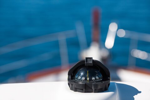
7. Charts have a compass rose printed on them in a magenta color in concentric circles. The outer circle is based on true north and the inner one is angled to point to magnetic north. Because the Earth’s magnetic field changes over time, the inner circle may be off by a couple of degrees and will have to be updated periodically. The compass rose tells you which direction you’ll need to navigate to reach your destination and you’ll need to choose whether you’ll be using true or magnetic north to determine which circle to use. When traveling short distances, the difference will matter little but when crossing oceans, a few degrees can make a big difference.
8. Distances are shown in either statute miles (inland waterways, lakes, Intercoastal Waterway) or nautical miles (1.15 statue miles) for offshore waters. A knot is a unit of measurement that depicts distance over time – as in traveling at 10 knots means you’ll make 10 nautical miles per hour.
9. Charts are a snapshot in time – the time they were created. However, buoys can drift off station and sandbars shift with weather. Always keep your eyes “out of the boat” to verify visual information and compare it with what you’re seeing on a chart.
10. Paper charts are the easiest to learn on while electronic charts, powered by GPS on multi-function displays (chartplotters), are what you’ll find on most boats today. A paper chart is like a map in that you don’t know where on it you are unless you’ve done dead reckoning (kept track as you navigate). E-charts on a plotter will display your current position thanks to GPS, which gives you an important piece of the puzzle. That said, it’s a lot more intuitive to learn the basics on paper charts rather than electronic ones. There’s a wealth of information on a nautical chart and it takes skill to read charts accurately and to be comfortable with them. Learning to read a chart is not only essential for navigation, it can also be fun.


